Tuesday, November 3, 2009

Day 7 - Buena Vista to Glenwood Springs via Independence Pass

Another huge climb loomed for the 103 mile final day, along with the start of the drive home to Illinois, so Arron set his alarm for 4:00 am hoping we could get a jump on the day.

I slept like junk the night in Buena Vista. I thought I heard an alarm sound and next thing I know Arron’s telling me it’s 4:30. Alright. Stumble around getting ready/packed and when I find my phone, the time reads 3:45 am. Seriously? I mean, really?? Yes. Arron’s phone somehow kicked ahead an hour, so we’re up and ready to go but it’s still pitch black outside. We loafed around getting the bikes ready and then parked it in the cafeteria to wait for some daylight.


Is it 5:00 am, yet?

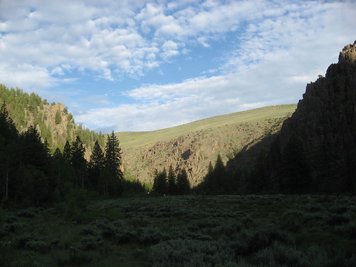
Around 5:30 we headed north on US-24 out of Buena Vista. Temps were between 45-50 degrees as the massive Collegiate peaks to our left kept us in shadows for an hour.* Mounts Yale, Columbia, Harvard, Oxford. All the schools Arron and I turned down to study in the heart of Illinois.
*edit - I realize now that this sentence would make sense if the sun rose in the west. Duh.


A headwind and a steady rise along the headwaters of the Arkansas River kept our pace slow. We could see sunlight on the mountains to our right, but only occasionally would we get any of its warmth when the sun popped out between peaks. At mile 20 we took a left turn onto CO-82, which we’d follow all the way back to Glenwood Springs.

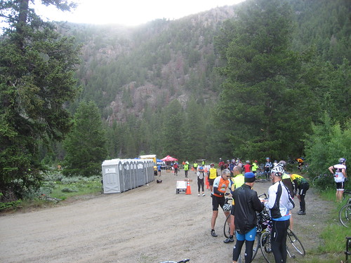
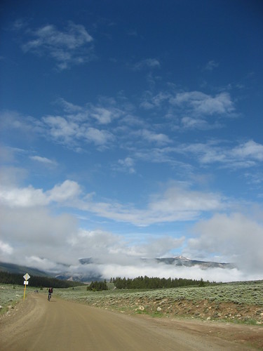
Along US-24 with the early risers.

At the first rest stop we met up with Portage Park and his crew (whom we had dubbed Team Budvar for the jerseys they were sporting on Day 2). Five of us headed out from the stop with La Plata Peak on our left and Colorado’s tallest peak Mount Elbert on our right. Both mountains top out over 14,300 feet. Soon it was just Portage Park, Arron, and I. Then Portage Park took off up the valley.

Mt. Elbert cloaked in clouds


More Mt. Elbert
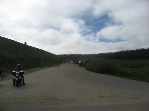
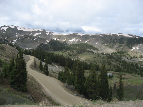
The pass is open for business.


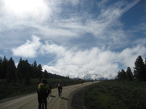
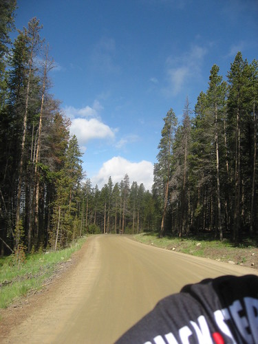
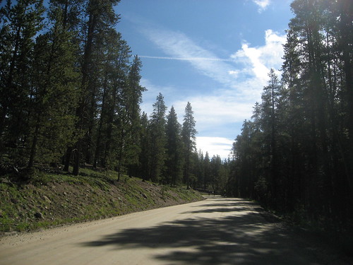
Arron and I rode along the incredible valley winding around the south base of Mount Elbert. The forest was thick with pines and firs as we passed the gate that closes the pass for most of the year. The elevation kicked up to 10,000 feet or so and soon we saw the road take a sweeping left turn and like a scar cut across the side of the mountain in front of us. I knew I’d be on my own for the ride to the top of the pass as Arron found his legs and took off ahead.

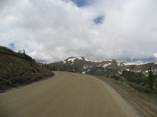
The view from this part of the climb was spectacular. The rock face sloping up on the right and a drop off to the left getting bigger by the pedal stroke as I passed the official ride photographers (“Remember Blue and 8:40!” they holler). The air chilled considerably and a waterfall of snowmelt loomed up ahead, but the road switched back before we got that far. I was riding pretty steady passing a few people and getting passed by a couple of wicked fast riders along the way. After one switchback I heard Arron’s voice from up above, but didn’t understand what he was saying. At least he was within earshot and I’m not totally dropped like on Cottonwood and Grand Mesa!


The climb went on for a long time, but seemed to go by in a blink for me. Soon painted on the road I read: “Fajitas: 3 Miles” and eventually “Fajitas: 1 Mile.” At this point the trees are nowhere to be found and then Cowbell Cathy is there at the final switchback yelling: “8/10 of a mile to go!! You’re so inSPIRing!!” Thanks Cowbell Cathy! You’re pretty inspiring, too, standing there all day by your lonesome cheering on the riders.

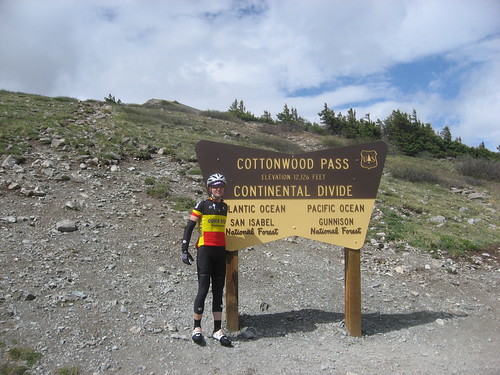
Snow fields are popping up and I see a couple of figures dancing around on the side of the road. It’s Portage Park and Arron. Arron’s got a camera in hand, so I upshifted to a bigger gear, jumped out of the saddle, and rocked it to the apex of Independence Pass. 12,095 feet and the top of the world as far as I was concerned. I let out a huge “YEAH!!” as I glided into the second rest stop at the top of the pass.

Top of the pass meant time for requisite photo op at the elevation sign. It was cool to get a shot with both of us on the final day. Thanks for waiting, Arron! Load up on some salty snacks from the food tents and we’re ready to basically coast down to Aspen.


The descent was dramatic. The top portion sliced across the mountain with a huge left turn visible from far away. Sketchy pavement with tons of bumps and holes (many marked in orange by the BTC crew). And it was cold downhill. Arron was out front and all over his brakes and I was doing my best to stay a good distance back without burning up the rims.

When we got back into the trees the road curved, narrowed, and just kept on going down for 17 miles. There was tons of traffic, much of which was trucks w/ campers crowding the lanes, so there was nowhere really to let it all hang out and fly as was the case coming off of Cottonwood Pass the day before. My top speed on the day was a mere 42.0 mph. When the signs said “Road Narrows” they meant it. Outcroppings to the right, steep drop offs to the left and only a guardrail to keep things in perspective.

Just before Aspen was the third and final rest stop of the week. We got there so fast, but it was a welcome break. I needed it to relax my tensed body and shaking legs/toes. Arron hops of his bike and just says, “My brakes are CASHED.” Crazy stuff.

The last 50 miles of the ride went through the town of Aspen and continued along Hwy 82 all the way to Glenwood Springs. Even though we were on a busy divided highway, this ride was completely opposite of the Grand Junction to Montrose slog of day 3. For one we were cruising ~21 or 22 mph for much of the way following a river to our right and great mountain scenery all around. The final 20 miles did seem to take forever, but soon we were back at Sopris Elementary and our 2009 BTC was at a successful end.


All the bags were laid out in the parking lot and ours were right at the front. No searching, no problem. We did run across our old buddy Gun Show in the lot. He was hopping out of a car gushing to his companion about what a great ride BTC had been. Yeah, right big guy, next time try riding all of it! There’s no way no day that he had ridden the whole 103 miles of Day 7’s route. Then again, we saw tons of people hopping the SAG vans throughout the whole week. For us it just did not compute why they were skipping some of the best parts of the route. I guess that’s their business and they can post it to their blogs, right?

Anyway, Arron went to get the car, we piled everything in, stopped at Wendy’s to refuel (Double with cheese, big fries, big Dr. Pepper!), and then hit the road for home. More on the ride home in a post to follow.

Thursday, October 29, 2009

Cottonwood Pass redux

Never fear. I'm almost done with my day 7 ride report, but found this and thought it was cool.

To contrast with my last post, here's a picture in the last few weeks at the top of Cottonwood Pass. Found this out at http://www.cottonwoodpass.net/ and hope Colorado Guy doesn't mind if I repost it here....


Wednesday, October 21, 2009

Day Six - Crested Butte to Buena Vista via Cottonwood Pass

(apologies for this extremely tardy entry)

Friday was BTC’s unofficial Gert Steegmans Appreciation Day. And a day to heed the following we had heard from more than one source: On a big climb day, get up and off the pass early.

The chilly 8000 foot temps at 6:00 am and anticipated climb to the highest point of the week had me going a bit overkill on clothing. In addition to the usual bibs, jersey, vest arm and knee warmers, I had on the only wool jersey I own (New Belgium merino!) and my old ratty PI tights. The added warmth was welcome at the start of the day. Arron was sporting his Quick Step Belgian champion look.

Hey, man, you didn’t earn that jersey!

One little kick up the hill out of Crested Butte just after 6 a.m. and we were headed downhill south toward Gunnison with a turnoff at Almont. The leg was an effortless warm up for the coming ascent along the Taylor River.

The canyon was really beautiful, lined with steep slopes filled with fir trees. The road was a really buzzy chip seal / rock tar combo. This is where we saw Arron’s doppelganger sporting an identical Belgian champ jersey. If I recall correctly we were just about to the first rest stop when we passed him. A minute or so later this guy passes us in full on attack mode, but does so by riding between the two of us. What the heck, man?


After a quick break we followed the river through canyons and a few remote ranches tucked away in the mountains.

Taylor River on the left.

Along the way we were passed by Tough Guy, who was desperately stuck on the wheel of Dr. Colorado. Tough Guy could usually be seen wandering the gym camping letting people know that that there was only one real challenging day on the week’s route. He was pretty cocky and wasn’t afraid to let anyone know he was a tough guy.

Tough Guy sucking some wheel.


22 miles later the river was dammed and the road tipped up to meet Taylor Reservoir. We road up above it on a ridge for a hundred or so feet and then swooped back down across a bridge, around another ridge, and to the second aid station. With Michael Jackson’s “Man in the Mirror” piping over the sound system we made it a pretty quick stop. My right shoulder blade was aching so I got a few Aleve from the medical station wagon. Skies behind us were looking a bit gray.

The road tilts up just past the dam.

A bit higher we go above the reservoir.

Clouds gathering over the lake at the western end of the pass. Rest stop two.

Upon leaving we hit the start of the 14 miles of dirt road that make up the western end of Cottonwood Pass. I took a quick video of us riding the semi-washboard. After a couple of miles The sun was out and I was burning up with too much warm clothing. Arron was jumping ahead and I could sense I wasn’t going to stay with him the whole climb (like on Grand Mesa) so I told him to go for it. I stopped to take off the wool jersey and stuff it into the back of my vest.

Sunny skies at the start of the dirt road.


The climb up Cottonwood was steady and not too steep. The road was bumpy, but the dirt was dry so traction was not an issue. I noted that I was riding between 6 and 8 mph. That sounds slow in retrospect. There were a lot more trucks/trailers/cars on the pass than I had expected, but they gave a wide birth to riders. Again the Colorado troopers were riding up and down the route to assist.

On the way up I spotted yet another rider sporting a QS Belgian Champion jersey. Was there a sale that I missed or something??

The 14 miles of the climb are marked from 0 at the reservoir counting up as the road approaches the top of the pass. At one point more than halfway up I reached into my vest pocket for the last of a Vanilla Crisp Power Bar. My glove stuck in the pocket and when I wrenched it free with bar remnant in hand, the wrapper went flying. Crap. I stopped and rode back down about 50 feet to reclaim the wrapper. That’s all I needed was to be riding down the pass before riding back up the pass!

A few miles from the top of Cottonwood Pass.

As the trees started to fade, the wind made it cold on my bare arms and unzipped vest. The turns in the road could be seen farther in the distance cutting across the side of the mountain dividing fields of dirty late June snow. Around mile marker 13 our good buddy Cowbell Cathy was rattling away letting us know there was only a mile to the top. Across one final ridge with a steep drop off on the right and I hit the top of Cottonwood Pass. 12,126 feet. That’s pretty high.


This shot's for the folks back at Uphill Grind Bicycles & Coffee.

I spent some time wandering around, getting the requisite pictures of the bike with the continental divide sign, me with the sign, a random kid playing on a summer snow pile, and the gathering clouds off in the distance from which we just climbed. Bob Seger’s “Roll Me Away” started playing on the sound system, which was a perfect choice. “Staring out at the great divide. I could go east, I could go west, It was all up to me to decide.”

In reality, though, there wasn’t much of a decision. Behind me was a dirt road and ominous weather. Ahead was a sweeping swath of pavement leading to the east. I cleaned the tires off with the palm of my glove and glided down toward Buena Vista, the Ramones “Blitzkrieg Bop” replacing Seger. Hmmm… Bob Seger > Ramones. That’s some juxtaposition there.

Looking back to the west from top of Cottonwood Pass.


Summertime snow fun. Eastern side of the top of the pass.
Stay on top of the pile, kid. That's a steep drop on the other side!

Start of the eastern side of Cottonwood Pass. Pavement!!
The descent off of Cottonwood was magnificent. The top few miles had some twists and turns. Somewhere along the way there was what I could only describe as a small speed bump across the road. I kind of hopped it and kept rolling, but that’s a bit scary at 40+ mph. The middle to bottom section of the pass had steeper straighter sections of pavement. At one point I looked down to see I was just floating along at 52 – 53 mph. This wasn’t the quick 50+mph downhills like we ride in Wisconsin, but went on for a long time. Thrilling.

The whole way to Buena Vista was fast. I got to the high school, found Arron, and set up camp. Tough Guy was in the gym holding court while downing a 64 oz recovery cola from the local Loaf & Jug. After settling in we headed out to find. Walking to the nearby Subway we looked back toward the pass to see the rain clouds enveloping the valley. By the time we made it across the street it was pouring rain. We had beaten the storm.
The pictures below were taken within a couple of minutes. The mountains just disappear by the third photo.


Where did the mountains go??!??
There were plenty of other riders who did not have such luck with the storm. Riders were coming into the gym shivering and blue. I loaned my wool jersey to one person who was without dry clothes while waiting for their gear to arrive. We heard stories of riders who were ferried down off the pass huddled in the back of the big yellow Penske moving vans used for SAG support. Sounded miserable, but I guess it was safer than them trying to descend a 12,000 foot pass in freezing rain.
Later in the afternoon the sun came back out and baked things back to summer. We wandered out again to grab lattes at Bronco Billy’s Buena Vista CafĂ©. They had wi-fi. So we sat and read the Denver Post’s coverage of the death of Michael Jackson and just chilled. I had a bowl of Red Pepper Bisque for dinner. It was pretty good.

View southwest of town to 14,197 foot Mount Princeton after the storm.


The view northwest of Mount Columbia and Mount Harvard from Bongo Billy's Buena Vista Cafe.


Only one more day to go and another 12,000 foot monster pass to climb before we head home.

Wednesday, August 19, 2009

BTC Day 7, Independence Pass

Buena Vista to Glenwood Springs. The last day and it's 107 miles! Over the Continental Divide AGAIN! Independence Pass and 12K AGAIN! I really can not think of a better way to end the tour.

The details: the day started early. Somehow the great AT&T network switched the iPhone back to the Central Time Zone. The plan was to awake very early since we needed to knock the ride out and hit the road to home. The iPhone alarm was set to 4:30am, which was really 3:30am.

So, we hung out in the cafeteria as we waited for the sun to peak out. I was tired and not happy. For the record though, this same AT&T early wakey wakey hands off snakey call got Portage Park and his crew too.

We rolled out uphill and into the wind. Man-o-man I was not into the first 20 miles. We trudged along taking turns pulling at 15 mph. It's crazy what a constent 2% grade, headwind, and tired legs can do to a cyclist. I was definetly feeling the effects of my Cottonwood Pass effort and early wake up call.

Finally we made a left hand turn, out of the headwind, towards the mountain and the first rest stop.

By design we didnt stay long at the first stop. We rolled out with Portage Park and his crew of three. Actually two of them dropped back and we road with Portage Park for a bit. He would speed up then coast back to us. He was ready to tackle this mountain. Tim and I played it smart and rode a comfortable pace. We still had a couple miles to go until we hit the main road up.

We were not totally sure which mountain top was the one since there were several to see on the approach.

At this point Tim and I rolled along at steady tempo. As we did i started to feel better. I started to get exicited and all giddy inside. We snapped pics and took video. It was weird, but i wanted to go go. however, in non typical Arron fashion I waited. It was way to early to pick up the pace. I remember Portage Park say that the difficult part of the climb didn't start until the big sweeping turn.

Wait for the big sweeping turn Arron.........at mile 38 and 10,800 feet it seemed like the waiting was over. I wish I had a better picture of this sweeping left hand turn. The above was snapped as I was coming out of it.

The road really kicked up from this point. It was awesome. Wwe had the rugged mountain on our right and the cliff with valley views to our left.

The road twisted up up up and away. At one point the tree line broke and I spotted Tim below. Ii yelled out numerous things to him;

-"we are doing it."
-"keep spinning"
-"team flatlanders unite"
-"this is awesome"

To which i think i heard him reply; "what?"

I was riding well, but this climb was hurting. I began looking for cowbell Kathy. I knew she would be there at one mile to go offering encourgement. Ding Ding Ding ding. Mman, that lady put a smile on my face. As I crept by her I informed her she was a saint and thanked her for the help.

One last turn and I could see the summit. I stood of course and stamped it out. I spotted a rider walking back down the climb a bit. It was Portage Park and he was cheering me on and snapping pictures of me as he waited for his crew to summit. That was nice.

After a quick tinkle I too went back and captured some pretty cool video of Tim destroying the final approach.

I was pumped to be at the top of this pass. the ride and trip we not over, but this was the IT of the trip. What it was all about. we just climbed the same pass that Levi, Horner, and some other dudes recently climbed in prep for some upcoming races.

Funny thing was we still had 60 plus miles on the bike and 1150 miles in the car before the end of this journey.

The decent was wicked scary, fast, tight, rough, and not fun. Tim can elaborate on that and the quickie through Aspen.

We climbed 4700 feet the first 43 miles.

Independence Pass Stats.
--17.1 miles of climbing
--3,015 feet climbed
--10.5 mph average
--136 bpm average with 156 bpm max
--79 rpm average cadence
--12,095 feet above sea level


We rolled back into Glenwood Springs where it all started with a smile on our faces and 550 miles in our legs.

It is a cheesy,but a classic cheesy saying; It's not about the destination, it's about the Journey. This trip was never about finishing first or top ten or whatever. Like many on a bike I tend to focus on the end. It would have been a shame to do that on this trip. From Cowbell Kathy to Portage Park to the Continental Divide to US 50 to the Bro Hug. I had a fantastic journey for sure.

*edit: looking for pictures for this post. me too?!@? words will have to do for now.

Friday, July 17, 2009

BTC Day 6, Cottonwood Pass.

The day would start in Crested Butte and end in Buena Vista. It was only 75 miles or so. However, toss in some dirt road and 12,000 feet to make this a can't miss Epic Day.

the ride out of CB started with a short 7% climb right out of the school parking lot. I had some odd tightness and soreness in the legs, which I blame on Crested Butte. I spent way too much time on my feet, walking around and enjoying that fabulous little town in the mountains.

Luckily this would be the only climbing we did for the next 20 miles. It was downhill and fast to the first rest stop. Something I really needed to shake everything loose. The decent took us down to 8100 feet. It was all uphill from there. We would gain 4000 feet in the next 30 miles.

The rest stop was near the little river town of Almont. Actually, you could call this a little three river town since three seperate rivers converge here. This is in the Gunnision National Forest and I thought the views from here to the top were the best of the trip.


The next 20 miles, or so, to the second rest stop twisted in and around the canyons of Gunnision National Forest. The sun was still coming up and I cannot explain how amazing it was. I wish I could find the words to convey it. We would climb up to roulghly 9100 feet to Taylor Park Reservoir and the second rest stop.


The road up Cottonwood Pass was dirt. Hard packed, but by no means smooth rolling. Tim has a great little video he took when we first hit the dirt that shows the "bumpyness". Despite rain the previous night it was not messy and barely splashed any mud on the ride. The next 14 miles would be on this road, gaining aproximately 2800 feet as we climbed to over 12k.


I am not sure where Tim and I parted ways on the climb. We both understood that we each had to ride our own ride to reach the summit. If we parted ways, we parted ways. Neither of us would ever leave our wingman intentionally, but sometimes on the road up it happens.

I felt like I was flying up the dirt road. Likely due to the large number of riders I was passing. Let me just say, not one rider passed me on the way up, but maybe the fast guys slept in again?? As I passed other riders I let them know the elevation and grade. They all seemed to enjoy having that knowledge. We would exchange words of encouragement as well. With each one of these exchanges I gained power, strength and excitement. I was alone, but not alone.

My legs were painfree and my mind was clear. Dare I say a cycling zen moment??


10,000 and counting...


Nearing the top....


But still Climbing...


My Favorite. Looking back at where I came from. Amazing...


The Summit, looking down the dirt road approach.


Yes I was rocking the Belgian National Champ Jersey. Hey, maybe that was the motivation and reason for my zen like ride. I mean, I had to represent.....or not. Not sure why I look so odd, but I will blame it on the climb.

While at the top taking in some PB&J I was approached by a man who asked:

Ohio Belgian: "Are you Belgian" he asked as he pointed at my kit.
me: "Uh, no. I'm from Chicago dude."

Come to find out he and his family are from Belgium, but currently live in Ohio, and were in Colorado on vacation. They were amazed at all the cyclist coming up the dirt road to the summit. After several fun minutes of discussion about what was going on he asked if he could take a picture with me. Of course, I said yes and his son lined it up and snapped away with some very large and fancy looking camera. I must have still been dizzy from the ascent and totally failed to pull out my own camera to capture the moment.


Climbing Stats: Cottonwood Pass

--13.54 miles of dirt road to the top
--2,730 feet climbed on that dirt road
--9.4 mph average
--148 bpm average with 160 bpm max
--79 rpm average cadence
--12,126 feet above sea level


The descent was the most technical yet. At the top it was fast with sharp u turns. I was hesitant to say the least. Near the bottom it straightened out and I let loose a bit. It is crazy how fast you lose the elevation you just spent hours achieving. Crazy I say! As you can see by my long arse post this day was amazing for me. One I will never forget.